English: Italia (Italy) Maps showing all or most of the territory (geographic area) of modern-day Italy - as the lands were in the 8th century (701-800 CE)
Italiano: Mappe che mostrano tutto o la maggior parte del territorio (area geografica) dell'Italia moderna (Italy) - come erano le terre nel VIII secolo (701-800 EC)
See Wikimedia Commons Atlas of Italy for a general overview of the territory including its evolution in European history.
Additional maps related to the history of Italy (including larger entities comprising or controlling the territory, smaller entities within the territory, and colonial territories) can be found at Maps of the history of Italy.

 Italy - as the lands were in the 8th century (701-800 CE)
 Frankenreich 768-811.jpg 1,400 × 1,180; 261 KB
 Frankish empire.jpg 1,755 × 1,241; 788 KB
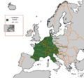 Carolingian Empire 481 - 814.GIF 579 × 535; 16 KB
%27_(11215808445).jpg/120px-194_of_%27(Italy_and_her_Invaders%2C_Vol._1-4.)%27_(11215808445).jpg) 194 of '(Italy and her Invaders, Vol. 1-4.)' (11215808445).jpg 2,375 × 2,204; 1.18 MB
194 of '(Italy and her Invaders, Vol. 1-4.)' (11215808445).jpg 2,375 × 2,204; 1.18 MB%27_(11219010023).jpg/120px-394_of_%27(Italy_and_her_Invaders%2C_Vol._1-4.)%27_(11219010023).jpg) 394 of '(Italy and her Invaders, Vol. 1-4.)' (11219010023).jpg 1,498 × 2,460; 1.2 MB
394 of '(Italy and her Invaders, Vol. 1-4.)' (11219010023).jpg 1,498 × 2,460; 1.2 MB.jpg/120px-Growth_of_the_Papal_stale_in_the_8th_century_(Johnston).jpg) Growth of the Papal stale in the 8th century (Johnston).jpg 986 × 963; 456 KB
Growth of the Papal stale in the 8th century (Johnston).jpg 986 × 963; 456 KB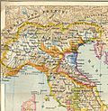 LangobardM.jpg 644 × 658; 141 KB
_Italy.png/120px-Lombard_(Kingdom_of)_Italy.png) Lombard (Kingdom of) Italy.png 1,609 × 1,333; 522 KB
Lombard (Kingdom of) Italy.png 1,609 × 1,333; 522 KB Spruner-Menke Handatlas 1880 Karte 21.jpg 3,453 × 2,983; 1.2 MB
.jpg/120px-Spruner-Menke_Hand-Atlas_fur_die_Geschichte_des_Mittelalters_und_der_neueren_Zeit._1880_(137083820).jpg)
 Южная Италия, 737 год.gif 281 × 349; 14 KB


%27_(11215808445).jpg)
%27_(11219010023).jpg)
.jpg)

_Italy.png)

.jpg)
